Figure 1: Optical image of Hong Kong (true colour synthesis)
Satellite technologies for flooding monitoring
Extreme rainstorms occurred in Hong Kong on the night of 7 September, with the one-hour rainfall breaking the highest record since 1884. A team of CUHK’s Institute of Space and Earth Information Science (the Institute) has leveraged the satellite technology to assist the government in analysing the flooding disaster.
Affected by the remnant rainbands of Typhoon Haikui, the Hong Kong Observatory issued a black rainstorm warning signal at 11:00 pm on September 7. As of 12:00 midnight, the one-hour rainfall of 158.1mm of rain was recorded. There were more than 200mm of rain recorded in areas such as the New Territories and Hong Kong Island, resulting in flooding and even landslides in many areas. The incidents affected urban traffic and the normal lives of citizens.
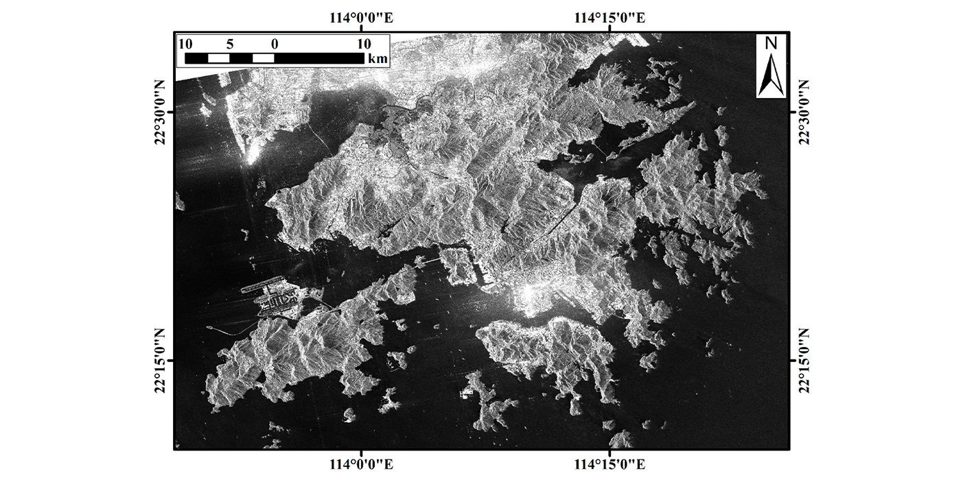

Compared to optical satellites, the Gaofen-3 SAR satellite can uniquely penetrate clouds and rain to perform remote sensing detection in disaster-stricken areas under extreme weather conditions such as heavy rains. The observation results of the Hong Kong area carried out by the Gaofen-3 satellite on September 7 are shown in Figure 2. By comparing SAR images taken at different times, researchers can monitor flooding in several disaster-stricken areas, as shown in Figure 3, where the red areas represent suspecte7d flooding areas. Judging from the analysis results, many areas are indeed flooded. Affected by floods, the results play an important role in disaster assessment and emergency measures.
The Institute of Space and Earth Information Science of CUHK is the only Hong Kong base of the National Remote Sensing Center of China. As Hong Kong’s unique national science and technology innovation platform in the field of satellite remote sensing, it is the only ground receiving station locally for remote sensing of satellite data. The Institute has been engaged in research on disaster monitoring and forecasting based on remote sensing images for years. It is committed to providing accurate disaster information to Hong Kong and around the world to reduce casualties and financial losses caused by natural disasters. This time, the Institute has conducted an effective analysis of rainstorm flooding disasters based on data from the national Gaofen-3 satellite. In the future, it will continue to use satellite remote sensing images to evaluate and conduct early warning research on risks such as flooding and landslides.
Photos/ CUHK’s Institute of Space and Earth Information Science


